
Home · Science · Sep 3 archive
Peatland Fires Darken Skies in Indonesia
Developing
In Short: NASA satellite images show a sharp increase in fire activity in Indonesia, with peat fires posing a significant threat as the country enters its fire season early this year.
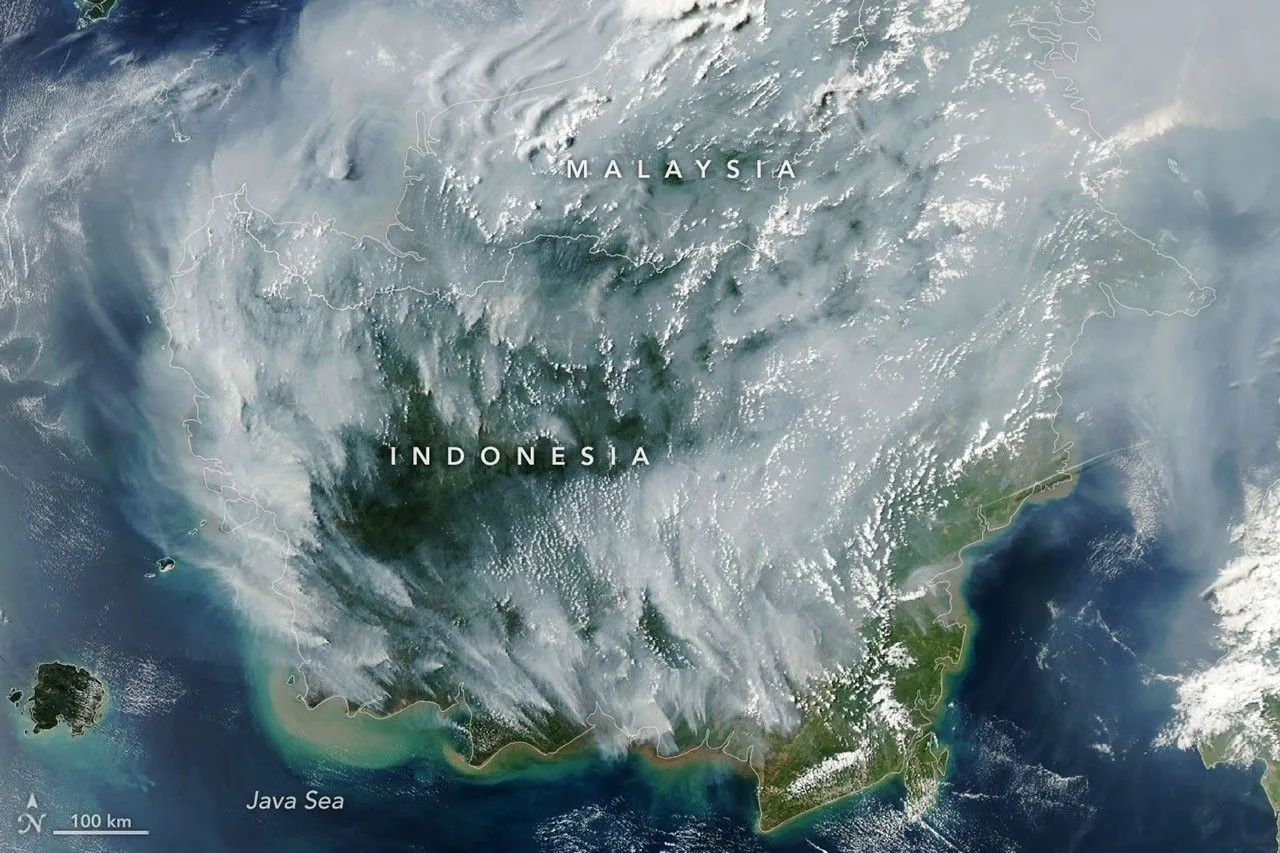
NASA's Aqua satellite captured images of fire activity in Indonesia on September 1, 2026, indicating a concerning trend in the early stages of the fire season.
Robert Field, a Columbia University researcher, noted that fire activity has risen sharply, similar to the 2015 fire season, which was particularly severe.
Indonesia experienced minimal rainfall in early August, with about 90 percent of the country receiving little to no precipitation, according to data from the Indonesian meteorological agency.
Peat fires, which can smolder underground, are particularly dangerous, as they are difficult to detect from space and can continue burning for extended periods, warned ecologist Mark Cochrane.
Background
Indonesia, officially the Republic of Indonesia, is a country in Southeast Asia and Oceania, between the Indian and Pacific oceans. Comprising between 13,000 and 17,000 islands, including Sumatra, Java, Sulawesi, and parts of Borneo and New Guinea, it is the world's largest archipelagic state and the 14th-largest country by area.
What's confirmed
What's still developing
- Fire season was underway in Indonesia when the MODIS (Moderate Resolution Imaging Spectroradiometer) on NASA's Aqua satellite captured this image on September 1, 2026.
- "Indonesia is only about three weeks into its fire season, but we're seeing fire activity track sharply upward, similar to 2015," said Robert Field, a Columbia University researcher who developed a tool called the…
- About 90 percent of the country received little to no rainfall in early August, according to data from the Indonesian meteorological agency.
- "Surface fires are less of a concern, but when fires get underground, they just won't stop," Field said.
- "The worst smoke events, paradoxically, can be the hardest to observe from space with MODIS and VIIRS," said Mark Cochrane, an ecologist at the University of Maryland Center for Environmental Science who has…